Punta Ala beaches Maremma: what to expect and how to plan your day from Barberino
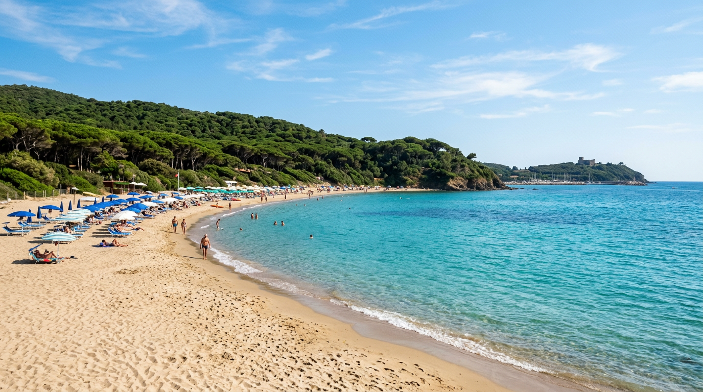
Punta Ala is a headland on the Maremma coast in the province of Grosseto, extending into the Tyrrhenian Sea between the Gulf of Follonica to the north and the bay of Castiglione della Pescaia to the south. A dense pine forest covers most of the promontory. The beaches on the southern and eastern sides of the headland are sheltered, sandy, and backed directly by this forest, creating an unusual combination of beach and woodland that defines the character of the place.
From Barberino Val d’Elsa the drive is approximately 130 kilometres. Allow 90 minutes without traffic. The distance puts Punta Ala at the outer range of a comfortable day trip, but for a beach that combines clean water, natural shade, and significantly lower crowds than the northern Tuscan coast, the drive is justified.
Punta Ala: Maremma beaches
The Maremma coast between Follonica and Castiglione della Pescaia is one of the least urbanised sections of the Tuscan coastline. National park designations and protected nature reserves have limited the development of the coastal zone. The beaches here tend to be cleaner, quieter, and more natural in character than those on the Versilia coast to the north, which is more densely built and more popular with mass tourism.
Punta Ala occupies the most seaward point on this stretch. The headland position means the water quality here is very good: the sea circulates freely around the promontory and the beaches are not affected by the river mouths or agricultural runoff that affect some coastal areas further north and south.
The seabed at Punta Ala shelves gently from the main beaches, making the first 20 to 30 metres of water shallow enough for families with young children and less confident swimmers. The water visibility is typically excellent in summer, especially on the calmer southern-facing coves.
The pine forest that backs the beaches provides natural shade within walking distance of the water. On a hot August day this is a significant practical advantage over beaches where the only shade comes from rented umbrellas.
The most beautiful beaches of Punta Ala
Cala Civette is the most secluded beach on the promontory. It sits on the southern tip, accessible only on foot via a path of about 15 minutes from the nearest road. The cove has rocky edges and clear water that can appear deep green or turquoise depending on the light. The combination of the walk required and the rocky character of the entry point keeps it considerably quieter than the main beach. Bring water shoes if you plan to enter from the rocks.
Spiaggia di Punta Ala is the main organised beach on the eastern side of the headland. It has a gentle sandy entry, sun loungers and umbrellas for hire, a bar with drinks and snacks, and easy access from the parking areas. This is the most family-friendly option and the most straightforward beach to use if you want facilities without walking.
The beach below the Punta Ala village and marina stretches north from the main facility. Some sections are free and without commercial infrastructure. The further north you walk from the main beach area, the quieter it becomes. The water quality is consistent across this stretch.
Cala Buracchio is a small rocky cove north of the main beach, accessible by a short coastal path. It is popular with snorkellers because the rocky bottom and clear water support a variety of marine life. The entry point is rocky rather than sandy, so water shoes are useful.
How to plan a day at the seaside
Depart from Barberino Val d’Elsa by seven in the morning. The drive takes 90 minutes and arriving by eight-thirty gives you first choice of position on both free and paid beach sections. The beach clubs at Punta Ala begin setting up from nine, but arriving before the main influx means you can also claim a spot on the free sections if that is your preference.
Morning is the best time for swimming. The water is calmer, the sun is at an angle that shows the colour of the sea most clearly, and the beach has not yet reached maximum heat. Plan your main swim between nine and twelve.
During the hottest part of the day, roughly 12:00 to 16:00, move into the pine forest if you are not using an organised beach with umbrella coverage. Short forest trails from the beach are pleasant in the shade and give you a different perspective on the promontory.
Budget approximately five to eight euros per day for a single sun lounger at an organised beach, or 20 to 35 euros for an umbrella-and-two-loungers combination. Prices are slightly lower than at Castiglione della Pescaia’s more famous establishments.
Carry cash. Beach bars, parking machines, and smaller food stalls at Punta Ala may not reliably accept card payment.
Where to have lunch in the area
Punta Ala village has a small selection of restaurants and cafes. The clientele is largely affluent Italian families and sailing visitors using the marina. Prices reflect this: a full meal here will cost more than the equivalent inland.
Castiglione della Pescaia, 15 kilometres south of Punta Ala by coast road, has a significantly better selection of restaurants and trattorias at a wider range of prices. Spaghetti alle vongole, grilled fish of the day, and fried seafood are the most reliable lunch choices in this part of the Maremma. A good trattoria meal in Castiglione typically costs 30 to 40 euros per person including wine.
For a more economical approach, prepare a picnic before leaving Barberino Val d’Elsa. Local cheese, salumi, bread, fruit, and a bottle of water take 20 minutes to assemble the night before and cost a fraction of a restaurant lunch. The pine forest at Punta Ala provides natural shade for picnicking within easy reach of the beach.
How to get there from Barberino Val d’Elsa
From Barberino Val d’Elsa take the SR2 Cassia south toward Siena. Follow the Siena ring road (raccordo) and continue south toward Buonconvento. At or before Buonconvento turn west and follow roads through the Maremma toward Grosseto. Before reaching Grosseto, take the Via Aurelia (SS1) northward toward Follonica. From the Follonica area, Punta Ala is about 15 kilometres south on roads that pass through Scarlino and approach the promontory from the north.
Total distance: approximately 130 kilometres. Estimated driving time: 90 minutes. The road through the Maremma after Buonconvento passes through open agricultural country and the Crete Senesi before descending into the coastal plain. This section of the route is consistently attractive.
In summer, the northern approach to Punta Ala from the Follonica direction can be slow on Saturday mornings when beach traffic is heavy. The southern approach from Castiglione della Pescaia is sometimes faster on these days.
Where to stay
Sogno d’Oro guesthouse in Barberino Val d’Elsa is 90 minutes from Punta Ala. For guests who want a single beach day during a stay focused on the Chianti and Val d’Elsa countryside, Punta Ala is a practical and rewarding choice: clean water, natural surroundings, and a drive that passes through some of the most interesting Tuscan landscapes on the way.